Kona Storm Causes Damage Across Hawaiʻi
Our take
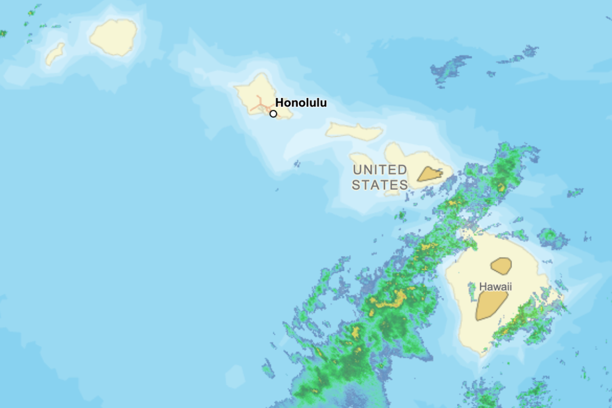
A powerful kona low battered the Hawaiian Islands last week, unleashing torrential rain that caused widespread flooding, landslides, sinkholes, road closures and downed power lines.
Governor Josh Green declared a State of Emergency in Hawaiʻi.
The National Oceanic and Atmospheric Administration (NOAA) explains that a kona low, or kona storm, typically forms during the winter months. The system is a type of low-pressure weather pattern that develops northwest of the Islands and can stall near them.
Unlike Hawaiʻi usual trade winds, a kona low brings cooler, moisture-rich winds from the south to southwest. This unusual wind direction can produce significant rainfall. NOAA notes that Leeward areas, which typically receive less rain, may face greater risk for landslides and flooding due to shallower soil and less vegetation cover.
The storm last week stalled north of the Islands for nearly five days, producing record-breaking rainfall. In West Maui, gauges recorded 28 inches at Puʻu Kukui in five days. Totals reached more than 40 inches in Upcountry Maui.
View this post on Instagram
According to the National Weather Service, as the kona low moves away from the Hawaiian Islands, periods of moderate showers may continue to linger over Maui and the Leeward Side of Hawaiʻi Island. Forecasters also warn that another round of heavy rain could develop later this week as a new area of low pressure forms west of the Islands.
The public is urged to continue exercising caution, especially near flooded roadways, streams and areas experiencing strong winds. Travelers should expect delays or cancelations as conditions continue to impact flights and transportation.
Read on the original site
Open the publisher's page for the full experience
Related Articles
- Hawaiʻi Flood Watch Issued after Back-to-Back Kona StormsFollowing a powerful kona storm that caused severe flooding and damage across Hawaiʻi last weekend, another kona low is developing, bringing a new round of heavy rains. The National Weather Service issued a Flood Watch for all of Hawaiʻi from 6 p.m. on Thursday, March 19, through 6 p.m. on Sunday, March 22. The developing low is expected to be weaker and hit leeward areas. However, the […]
- WEATHER UPDATE: The risk of flash flooding will continue across the islands this weekend as a kona storm moves through the regionUpdates As of 4:30 AM HST on Sunday: The surface low associated with the kona storm is now well to the north of the islands. Several bands of moderate to heavy rain, with some embedded thunderstorms, continue to move slowly eastward across the islands this morning. Hazardous weather will slowly taper off today, though the risk of flash flooding will continue into Monday. A 'wet trades' weather pattern will settle into the area on Tuesday and will continue through the weekend. Forecast synopsis From the National Weather Service office in Honolulu: As of 3:19 AM HST on Sunday: A surface kona low pressure system continues to meander northeastward away from the Hawaiian Islands, producing bands of moderate to heavy showers and embedded isolated thunderstorms across much of the state, namely Maui County and the Big Island. As the system exits the vicinity of the islands, a broad area of high pressure fills in its wake Monday, allowing trades to return from west to east, persisting through the remainder of the week. Windward showers will initially be scattered to numerous Monday, but will decrease to a more typical trade wind regime with isolated to scattered showers across windward and mauka areas. Weather risk outlook As of 3:00 PM HST on Saturday: A full island-by-island risk outlook has not yet been produced. Location Sun Mon Tue Wed Kauaʻi · · · · Oʻahu 2 · · · Maui 2 1 · · Hawaiʻi 1 1 1 · NOTE: The overall risk for Oahu is moderate because of conditions at the Wahiawa Dam. The chance of further flash flooding from rainfall remains low. Key: · - little to none; 1 - minor; 2 - moderate; 3 - major; 4 - extreme More information For more information on the impacts of this system as it develops, please check out these links: National Weather Service NWS Honolulu homepage NWS Honolulu Area Forecast Discussion NWS Honolulu on Facebook NWS Honolulu on X Hawaii Emergency Management Agency HawaiiEMA home page HawaiiEMA on Facebook HawaiiEMA on X HawaiiEMA on Instagram submitted by /u/giantspeck [link] [comments]
- WEATHER UPDATE: Another kona storm may bring periods of moderate or heavy rain throughout the week, bringing renewed concerns for flooding across the islandsKey points As of 9:00 AM HST on Monday, April 6: Monday: Winds will begin to weaken and shift to a more easterly to southeasterly direction. Isolated rain showers are possible, particularly over windward and mauka areas. Tuesday: Winds will shift to a more southerly direction, pulling abundant moisture up from the deep tropics. Isolated rain showers are possible, particularly over leeward and mauka areas. Isolated downpours are possible over areas of higher terrain. Wednesday through Friday: An area of low pressure is likely to develop to the northwest of Kauaʻi on Wednesday. A series of upper-level disturbances will move across the islands over the next few days. Instability from these disturbances combined with the added moisture will result in periods of moderate to heavy rain, which could lead to flash flooding. Upcoming weekend: Rainfall intensity may decrease over the weekend, but the threat of flash flooding could continue as the ground will remain saturated from the accumulated rain from earlier in the week. Early next week: Long-range model guidance suggests that a second system could set up directly behind this storm, so impacts could continue into the upcoming week. Forecast synopsis As of 9:49 AM HST on Monday, April 6: From the National Weather Service office in Honolulu: Mostly dry and pleasant trade wind weather will continue today, with brief passing showers favoring windward and mauka areas. A significant pattern change is then expected by Tuesday as an upper disturbance and surface low pressure evolve northwest of the islands. This system is expected to draw deep tropical moisture northward over the state, leading to an extended period of southerly winds, increased chances for widespread rainfall, and renewed flooding concerns from from the middle of the week through the weekend. Weather risk outlook As of 8:00 AM HST on Monday, April 6: Island MON TUE WED THU FRI Kauaʻi · · 1 2 2 Oʻahu · · 1 2 2 Maui · · 1 2 2 Hawaiʻi · 1 1 2 2 Key: · - little to none; 1 - minor; 2 - moderate; 3 - major; 4 - extreme Projected rainfall totals: As of 9:00 AM HST on Monday, April 6: Below are some preliminary projections for rainfall between now and 10:00 PM HST on Saturday, April 11. Please note that it remains far too early to determine the exact timing and severity of any potential rainfall, and large differences in rainfall totals in the table below may be from large differences in timing and the location of the heaviest rain. City NWS ECMWF GFS Lihue 6.0 5.6 6.7 Honolulu 5.6 4.3 7.3 Wahiawa 7.5 5.2 5.1 Kaneohe 7.2 5.7 5.9 Kahului 3.3 4.0 4.8 Hana 4.2 14.0 7.5 Molokai 5.7 3.5 5.6 Lanai 4.3 5.6 7.1 Hilo 3.4 13.0 4.4 Kona 3.3 3.5 3.3 More information For more information on the impacts of this system as it develops, please check out these links: National Weather Service NWS Honolulu homepage NWS Honolulu Area Forecast Discussion NWS Honolulu on Facebook NWS Honolulu on X Hawaii Emergency Management Agency HawaiiEMA home page HawaiiEMA on Facebook HawaiiEMA on X HawaiiEMA on Instagram submitted by /u/giantspeck [link] [comments]